
Thornton ZIP Codes and Coverage
The Census profile identifies eight five-digit ZCTAs that are fully or partly within the Thornton city profile. A ZCTA is a statistical approximation, while USPS assigns a delivery ZIP to an exact address. The table keeps those ideas separate and names the postal clue found in the research.
| ZIP / ZCTA | Thornton relationship | Post office clue | Research note |
|---|---|---|---|
| 80023 | Partial northern and western edge | Broomfield Main Office | Created from 80020 effective July 1, 2007 |
| 80221 | Partial southwest or west edge | North Pecos service area | Nearby postal place may read Denver |
| 80229 | Central and south Thornton area | Thornton station, 8804 Washington Street | Strong direct Thornton postal clue |
| 80233 | Partial southern or western boundary | Northglenn location | Postal place and city line can diverge |
| 80241 | North and central Thornton, including Eastlake area | Thornton classified branch | Last line changed from Denver to Thornton in 2010 |
| 80260 | Partial west side | North Pecos service area | Shared metro boundary requires exact lookup |
| 80601 | Northeast and east partial overlap | Brighton Main Post Office | Not every 80601 address is in Thornton |
| 80602 | Northern and eastern partial overlap | Brighton carrier or annex area | Verify the municipal boundary and parcel |
A ZIP code directory row is a routing clue. It does not contain a resident list, household count, or citywide population total.
80023 and Thornton's ZIP Edge
USPS Postal Bulletin material says ZIP 80023 was established from Broomfield 80020 effective July 1, 2007. That change gives a historical search an anchor. A newspaper, directory, permit, or family paper from before the realignment may use 80020, while a later source may use 80023 for a nearby address. The postal change does not by itself define Thornton’s city boundary.
Use the exact street and city-state combination in the USPS ZIP Lookup. Then compare the result with the Adams or Weld parcel map, the legal description, and the source date. A ZIP code directory that skips this step can attach a postal place to the wrong municipality.
The 2007 bulletin is a useful comparison point for older records because it dates a postal change rather than a person’s move.
The USPS 80023 notice records the realignment that belongs beside an older Thornton address.
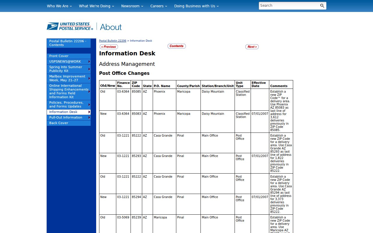
Keep the bulletin date and the address date together when normalizing a historical last line.
80241's Thornton Last Line
USPS Postal Bulletin material says the preferred last line for 80241 changed from Denver to Thornton effective August 14, 2010. The parcel did not need to move for a historical source to show a different city line. That makes 80241 a practical explanation for a directory or court filing that looks inconsistent with a current address.
When a record has 80241, preserve its printed last line, then add the current USPS result in a separate field. Search the old and new forms in a library index, newspaper database, deed record, or permit record. If the address is near Eastlake, also search that place label because the city’s 1990 incorporation history can overlap the postal change.
The 2010 USPS bulletin entry supplies the date that should be cited with a 80241 address-history note.
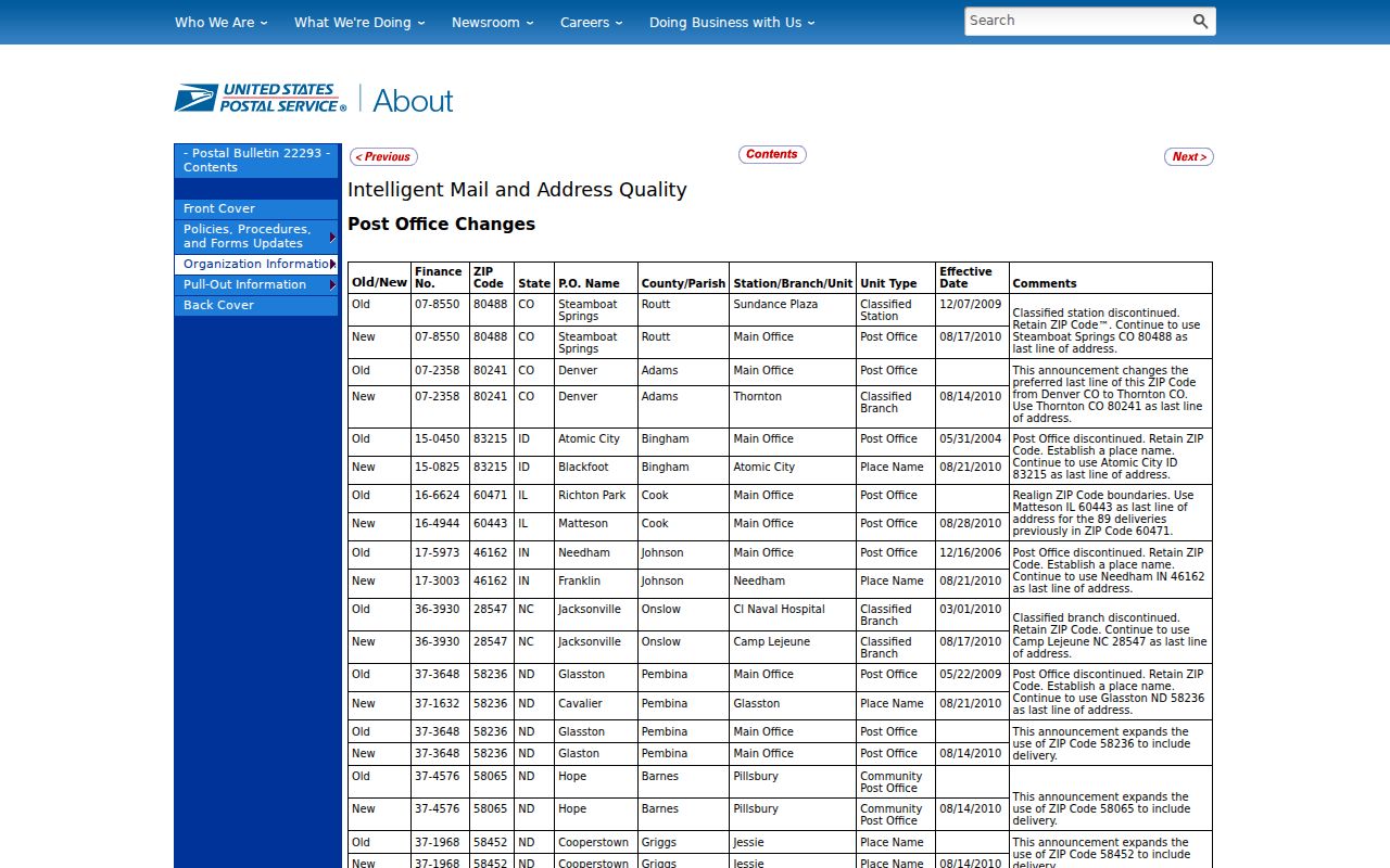
A postal last-line change is a normalization fact. It is not evidence that a resident changed at the same time.
Brighton Service Areas in Thornton
ZIP 80601 and ZIP 80602 overlap the eastern or northern Thornton profile, yet the postal clues point toward Brighton. USPS lists Brighton Main Post Office at 90 N 4th Avenue and associates Brighton service with 80601, 80602, and 80603. That does not make every address in either ZIP a Brighton city address. Use the exact-address lookup and then plot the parcel.
Official Thornton permit material can show local 80602 addresses, while Adams or Weld systems decide the parcel and records custodian. The city boundary, postal place, and county can all be different fields in one research note. Keep them separate in a ZIP code directory entry.
The USPS location record for a Thornton-area service point shows why a nearby postal facility is only a clue.
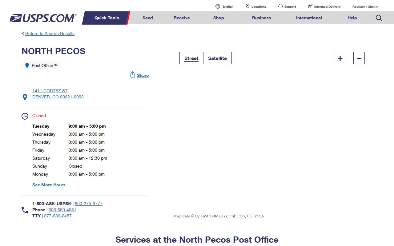
The service location helps explain routing geography, but an exact address still controls the final ZIP and city line.
Thornton's West and South ZIP Edges
ZIP 80221, 80233, and 80260 sit along shared metro edges. The research points to the North Pecos service area for the west-side geography and a Northglenn location for 80233. The postal place in a record may therefore read Denver or Northglenn even when a nearby parcel lies in or near Thornton. A ZIP code directory should report the overlap rather than force one city label.
For a specific name or address, begin with USPS, then use Adams GIS or the Weld property portal if the boundary requires it. The assessor can return a parcel and mailing field, but it does not create a ZIP-wide resident result. A street-level result belongs in the street directory once the ZIP has done its narrowing work.
The Thornton-area USPS location record is a useful local postal reference for the edge comparison.
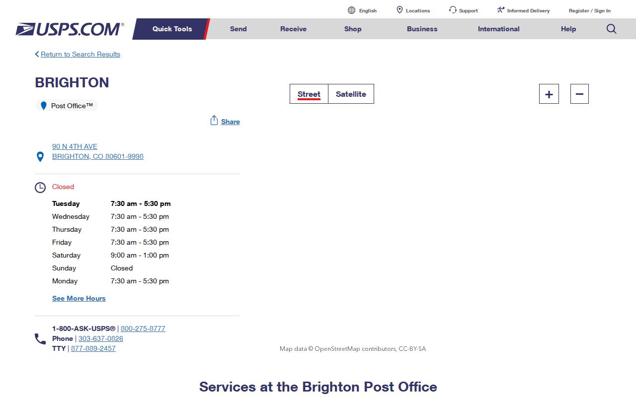
Use the location record as context, never as a substitute for an exact-address lookup.
Find Thornton Residents by ZIP
A ZIP narrows geography, but the resident question still needs a record type. Use this sequence when a name or address comes with a ZIP:
- Run the complete street, city, and state through USPS to confirm the delivery ZIP and preferred last line.
- Check the Census profile only for the ZCTA relationship; do not treat it as an exact postal boundary.
- Resolve the parcel in Adams QuickSearch, Adams GIS, Thornton CityView, or Weld’s property portal.
- Choose the record that fits the question: voter file for a dated registration, deed index for a property party, court docket for a case event, or library collection for a historical lead.
- Save the ZIP, city line, parcel, record date, and source role together.
There is no inspected official portal that returns every Thornton resident by ZIP. A name and ZIP can be a search input, but the result must still be interpreted through the custodian’s rules.
Thornton ZIP Search Fields
The local portal sweep found one exact postal lookup and several parcel tools. None of the Adams or Thornton property interfaces exposed an open ZIP-wide resident search. The fields below describe the available routes without promising controls that the live JavaScript shells did not show.
| USPS address lookup | Full street, city, and state to ZIP, or street plus ZIP to a standardized address. |
|---|---|
| Adams QuickSearch | Address or parcel workflow. A public ZIP filter was not located. |
| Adams GIS | Parcel identify result can display mailing city, state, and ZIP after a parcel is selected. |
| Thornton CityView | Property Address or Parcel Number with text and autocomplete; no public ZIP filter was located. |
| Weld Property Portal | Address portion, owner, account, parcel, subdivision, or section-township-range fields; no ZIP-wide export was exposed. |
| Adams voter files | Dated files may contain an address or ZIP column, but current headers must be read before use. |
That field audit keeps a ZIP code directory honest. USPS validates delivery geography; county and city systems resolve records after the address is known.
Thornton ZIP, Parcel, and Situs
Three labels often travel together but should not be merged. A ZIP code is a postal routing area. A parcel is a mapped and legally described unit. A situs address is the physical location assigned to that parcel. A mailing address can be somewhere else. The ZIP code directory uses the first label to narrow the search and the other three to test whether the record belongs to the same place.
- ZIP code
- A USPS delivery code assigned to an exact address, not a full city boundary.
- ZCTA
- A Census statistical approximation that may partly contain Thornton.
- Parcel
- A county-mapped property unit with an identifier and legal description.
- Situs address
- The physical location of the parcel, distinct from a mailing address.
- ZIP+4
- A more specific postal extension used by USPS, not a resident index.
When an old source uses a different last line, retain its printed form and add a normalized current form. The legal description, parcel number, and source date are the bridge.
Thornton City Limits Versus ZIP Areas
The 2020 Census profile lists a Thornton population of 141,867, with a 2025 estimate of 147,766. Those figures describe the city profile, not a sum that can be split across the eight ZCTAs in this research. Postal areas cross city lines, and a ZCTA can cover only part of Thornton. Do not convert a ZIP row into a city population or resident count without an official method.
| Question | Best source | What it does not answer |
|---|---|---|
| What ZIP serves this address? | USPS exact-address lookup | Who receives mail there |
| Is the parcel in Thornton? | Thornton CityView and county GIS | Every household member |
| Who owns the parcel? | Adams or Weld assessor and recorder | Current occupant status |
| Is a person registered at a date? | Colorado or Adams voter source | How the person voted or current presence |
The Census Thornton profile capture makes the statistical boundary distinction visible.
Use the profile for ZCTA context, then return to USPS and the parcel custodian for an address-specific answer.
Thornton ZIP Directory Research Limits
Postal geography can reconcile a historical record, locate a service area, or narrow a parcel search. It cannot supply a public list of current residents. Adams voter files are dated and omit protected fields. GIS returns parcel and owner fields, not a household roster. CityView returns property and permit context. Reverse directories depend on edition and place coverage.
Best practice: cite the exact ZIP, source date, USPS last line, municipal boundary result, and parcel identifier. If the ZIP and city appear to disagree, preserve both values and explain the route used to reconcile them.
Once a ZIP narrows to a street, move to the Thornton street directory for the address-keyed chain. Keep the ZIP as one field in that record, not as a conclusion about a person.